Between Albion Place and Albion Street
Introduction
The photograph on this page of Between Albion Place and Albion Street by John S Turner as part of the Geograph project.
The Geograph project started in 2005 with the aim of publishing, organising and preserving representative images for every square kilometre of Great Britain, Ireland and the Isle of Man.

There are currently over 7.5m images from over 14,400 individuals and you can help contribute to the project by visiting https://www.geograph.org.uk
Between Albion Place and Albion Street
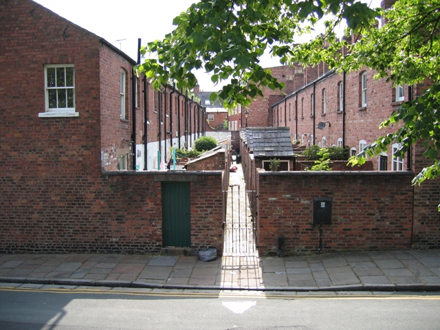
Image: © John S Turner Taken: 5 Jun 2007
This view from the city walls in Park Street is of the alley and backyards between Albion Place on the left and Albion Street. Interestingly the old outside privies for Albion Street seem to be more substantial than the ones for Albion Place, and the backyards on the right are also longer.
Images are licensed for reuse under creativecommons.org/licenses/by-sa/2.0
Image Location
Latitude
53.187956
Longitude
-2.88802