Scorguie Court, Inverness
Introduction
The photograph on this page of Scorguie Court, Inverness by Malc McDonald as part of the Geograph project.
The Geograph project started in 2005 with the aim of publishing, organising and preserving representative images for every square kilometre of Great Britain, Ireland and the Isle of Man.

There are currently over 7.5m images from over 14,400 individuals and you can help contribute to the project by visiting https://www.geograph.org.uk
Scorguie Court, Inverness
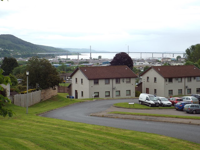
Image: © Malc McDonald Taken: 22 Jun 2015
Scorguie Court is a residential cul-de-sac built on a hillside in Inverness. This view looks north east. In the background is the Kessock Bridge, which carries the trunk A9 road north from Inverness onto the Black Isle peninsula. Beyond the bridge is the Moray Firth.
Images are licensed for reuse under creativecommons.org/licenses/by-sa/2.0
Image Location
Latitude
57.481452
Longitude
-4.254119