Culvert in stone base of the Antonine Wall
Introduction
The photograph on this page of Culvert in stone base of the Antonine Wall by Lairich Rig as part of the Geograph project.
The Geograph project started in 2005 with the aim of publishing, organising and preserving representative images for every square kilometre of Great Britain, Ireland and the Isle of Man.

There are currently over 7.5m images from over 14,400 individuals and you can help contribute to the project by visiting https://www.geograph.org.uk
Culvert in stone base of the Antonine Wall
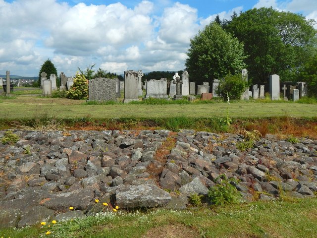
Image: © Lairich Rig Taken: 3 Jul 2015
This is the more easterly of two exposed sections of the stone base of the Antonine Wall that are to be seen in New Kilpatrick Cemetery. For views of this section as a whole, and for more information, see Image, Image and (from the other end) Image Like the more westerly section, this one is crossed obliquely by a culvert, an original feature of the Wall, allowing for drainage. The line of the culvert is clearly visible in the present picture. For the other (the more westerly) section of the stone base, see Image; for its culvert, see Image
Images are licensed for reuse under creativecommons.org/licenses/by-sa/2.0
Image Location
Latitude
55.922884
Longitude
-4.310357