Blackheath drill hall
Introduction
The photograph on this page of Blackheath drill hall by Stephen Craven as part of the Geograph project.
The Geograph project started in 2005 with the aim of publishing, organising and preserving representative images for every square kilometre of Great Britain, Ireland and the Isle of Man.

There are currently over 7.5m images from over 14,400 individuals and you can help contribute to the project by visiting https://www.geograph.org.uk
Blackheath drill hall
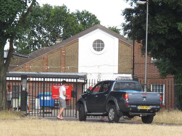
Image: © Stephen Craven Taken: 10 Jul 2015
According to fellow contributor John Maddan, this is "probably the hall shown on the 1896 1:2500 mapping and later surrounded by other buildings, built for the Second West Kent Volunteers and after 1908 used by the Twentieth Battalion London Regiment". The building is now part of the Blackheath Territorial Army Cadet Centre Image, which is set in an enclosed compound at the western end of the heath, largely surrounded by trees. I did seek permission through official channels to take photos inside the site but this was declined, so am just submitting one photo taken from a distance.
Images are licensed for reuse under creativecommons.org/licenses/by-sa/2.0
Image Location
Latitude
51.470219
Longitude
-0.005333