Coney Weston village hall
Introduction
The photograph on this page of Coney Weston village hall by Evelyn Simak as part of the Geograph project.
The Geograph project started in 2005 with the aim of publishing, organising and preserving representative images for every square kilometre of Great Britain, Ireland and the Isle of Man.

There are currently over 7.5m images from over 14,400 individuals and you can help contribute to the project by visiting https://www.geograph.org.uk
Coney Weston village hall
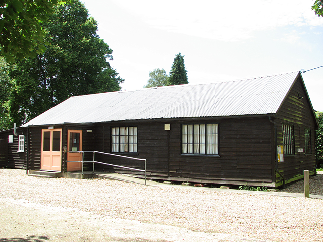
Image: © Evelyn Simak Taken: 10 Jul 2015
After WW1, the wooden building along with the land on which it stands was given to the village by William Needham Champion of Coney Weston House which is situated across the road from it. Because of a red triangle affixed to its front (but since removed) it was known locally as the Red Triangle Hut. During WW2, 20 Nissen huts and associated buildings of one of the domestic sites of RAF Knettishall (Site 7) adjoined it and during this time the hall was used as a cinema. Except for new windows and a porch (seen here), the latter added to the main entrance in 2006, the hall is an original WW1 building and currently used for regular village events, Parish Council and Women's Institute meetings.
Images are licensed for reuse under creativecommons.org/licenses/by-sa/2.0
Image Location
Latitude
52.364754
Longitude
0.875822