Up Alfred Street North
Introduction
The photograph on this page of Up Alfred Street North by John Sutton as part of the Geograph project.
The Geograph project started in 2005 with the aim of publishing, organising and preserving representative images for every square kilometre of Great Britain, Ireland and the Isle of Man.

There are currently over 7.5m images from over 14,400 individuals and you can help contribute to the project by visiting https://www.geograph.org.uk
Up Alfred Street North
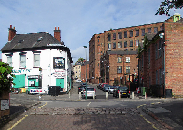
Image: © John Sutton Taken: 6 Jul 2015
The Mechanics' Arms, an Irish pub, is on the left, the Grade II listed Oldknow's Factory ahead (see http://www.britishlistedbuildings.co.uk/en-492001-oldknows-factory-#.VZ_f5CiwHZY ) and St Andrew's Parish Hall on the right.
Images are licensed for reuse under creativecommons.org/licenses/by-sa/2.0
Image Location
Latitude
52.963051
Longitude
-1.149417