Going to school in St Ann's
Introduction
The photograph on this page of Going to school in St Ann's by John Sutton as part of the Geograph project.
The Geograph project started in 2005 with the aim of publishing, organising and preserving representative images for every square kilometre of Great Britain, Ireland and the Isle of Man.

There are currently over 7.5m images from over 14,400 individuals and you can help contribute to the project by visiting https://www.geograph.org.uk
Going to school in St Ann's
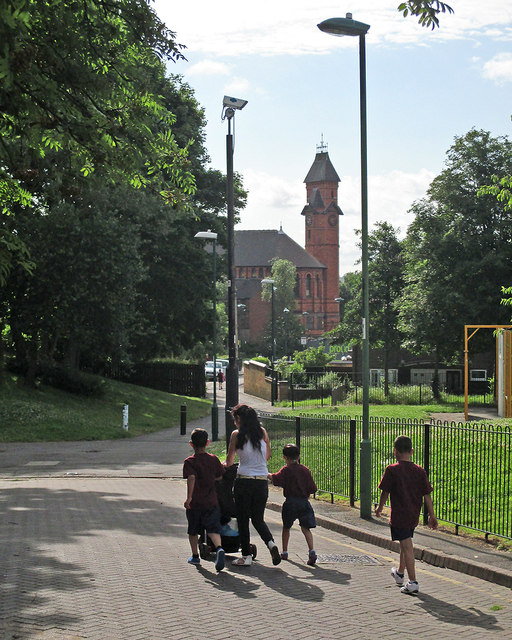
Image: © John Sutton Taken: 6 Jul 2015
Now Welbeck Walk, this was once Alfred Street, one of the main thoroughfares in St Ann's, whose slum terraces were demolished in the 1970s and replaced by low-density housing. In the background is Watson Fothergill's Woodborough Road Baptist Church, now the Pakistan Centre (see Image]).
Images are licensed for reuse under creativecommons.org/licenses/by-sa/2.0
Image Location
Latitude
52.962863
Longitude
-1.14823