Holywood (elevated view) July 2015
Introduction
The photograph on this page of Holywood (elevated view) July 2015 by Albert Bridge as part of the Geograph project.
The Geograph project started in 2005 with the aim of publishing, organising and preserving representative images for every square kilometre of Great Britain, Ireland and the Isle of Man.

There are currently over 7.5m images from over 14,400 individuals and you can help contribute to the project by visiting https://www.geograph.org.uk
Holywood (elevated view) July 2015
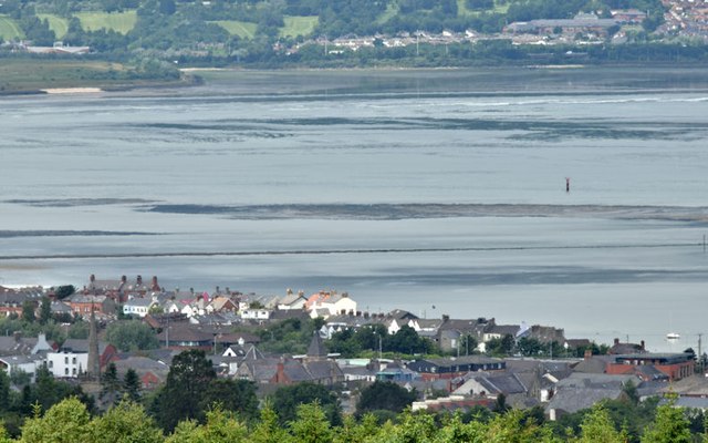
Image: © Albert Bridge Taken: 9 Jul 2015
An elevated view of Holywood from over this gate Image on the Creighton’s Green Road. For reference the library http://www.geograph.org.uk/search.php?i=56746677 is towards middle bottom. At about an hour after low water Belfast there is plenty of sand and inter-tidal mud on view in Belfast Lough.
Images are licensed for reuse under creativecommons.org/licenses/by-sa/2.0
Image Location
Latitude
54.64043
Longitude
-5.836484