Bournemouth: East Cliff United Reformed Church
Introduction
The photograph on this page of Bournemouth: East Cliff United Reformed Church by Chris Downer as part of the Geograph project.
The Geograph project started in 2005 with the aim of publishing, organising and preserving representative images for every square kilometre of Great Britain, Ireland and the Isle of Man.

There are currently over 7.5m images from over 14,400 individuals and you can help contribute to the project by visiting https://www.geograph.org.uk
Bournemouth: East Cliff United Reformed Church
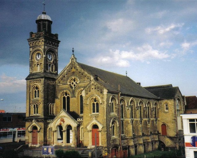
Image: © Chris Downer Taken: Unknown
Amid plenty of more modern development, this is the East Cliff United Reformed Church, whose clock was got going again a couple of years back after an appeal. It is set a few minutes fast to chivvy along commuters on their way to the railway station opposite.
Images are licensed for reuse under creativecommons.org/licenses/by-sa/2.0
Image Location


Leaflet Map data © OpenStreetMap
Latitude
50.72565
Longitude
-1.862099