Farm Mews
Introduction
The photograph on this page of Farm Mews by Simon Carey as part of the Geograph project.
The Geograph project started in 2005 with the aim of publishing, organising and preserving representative images for every square kilometre of Great Britain, Ireland and the Isle of Man.

There are currently over 7.5m images from over 14,400 individuals and you can help contribute to the project by visiting https://www.geograph.org.uk
Farm Mews
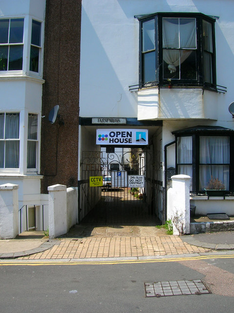
Image: © Simon Carey Taken: 3 Jun 2007
Housing lines the western side of Farm Road for its entire length. The space between Farm Road and Lansdowne Place has been filled with small mewses with access under the buildings. Originally used as service and stabling for the grander houses in Lansdowne Place they are now occupied by housing. The Open House sign refers to the current Brighton Festival which runs throughout May whereby artists are able to set up their own galleries showing their own work often in their own homes which are published in the Festival guide for those who wish to visit.
Images are licensed for reuse under creativecommons.org/licenses/by-sa/2.0
Image Location
Latitude
50.82686
Longitude
-0.159257