The old school
Introduction
The photograph on this page of The old school by Michael Dibb as part of the Geograph project.
The Geograph project started in 2005 with the aim of publishing, organising and preserving representative images for every square kilometre of Great Britain, Ireland and the Isle of Man.

There are currently over 7.5m images from over 14,400 individuals and you can help contribute to the project by visiting https://www.geograph.org.uk
The old school
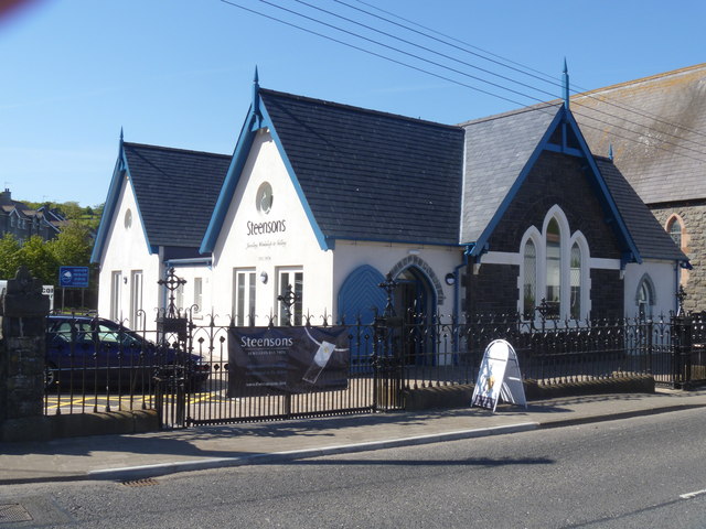
Image: © Michael Dibb Taken: 10 Jun 2015
Located next to the church Image the school house was built in 1888 and remained in use as a school until the 1960s when the present school building was constructed on the other side of the church. The building then served as the church hall before becoming a jewellery workshop.
Images are licensed for reuse under creativecommons.org/licenses/by-sa/2.0
Image Location
Latitude
54.968133
Longitude
-5.951798