High Street, Rushden
Introduction
The photograph on this page of High Street, Rushden by Bikeboy as part of the Geograph project.
The Geograph project started in 2005 with the aim of publishing, organising and preserving representative images for every square kilometre of Great Britain, Ireland and the Isle of Man.

There are currently over 7.5m images from over 14,400 individuals and you can help contribute to the project by visiting https://www.geograph.org.uk
High Street, Rushden
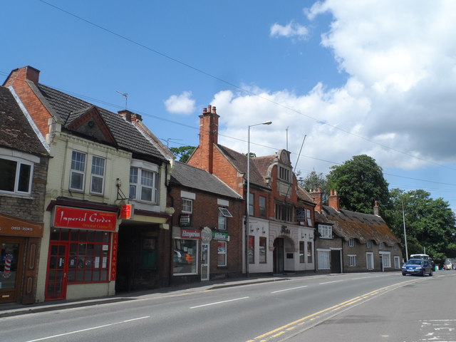
Image: © Bikeboy Taken: 27 Jun 2015
The thatched building on the far right was built in the early C18. From 1921 until around 1985 it was home to Florence Simpson Ltd (milliners). See http://www.rushdenheritage.co.uk/commerce/florencesimpson.html for more details.
Images are licensed for reuse under creativecommons.org/licenses/by-sa/2.0
Image Location
Latitude
52.287146
Longitude
-0.598563