The Red House, High Road, EN10
Introduction
The photograph on this page of The Red House, High Road, EN10 by Mike Quinn as part of the Geograph project.
The Geograph project started in 2005 with the aim of publishing, organising and preserving representative images for every square kilometre of Great Britain, Ireland and the Isle of Man.

There are currently over 7.5m images from over 14,400 individuals and you can help contribute to the project by visiting https://www.geograph.org.uk
The Red House, High Road, EN10
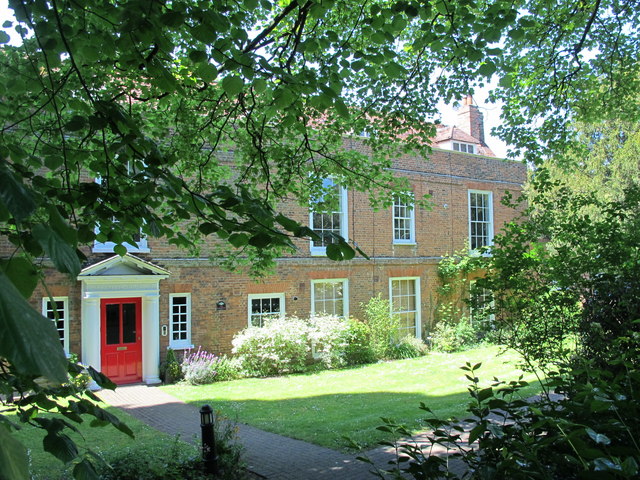
Image: © Mike Quinn Taken: 27 May 2015
This early 18th C building was at one time used as the clubhouse of Broxbourbe Golf Club. After Broxbourne School was built in 1962, it was used as the 6th form block. It was subsequently converted into flats. The building is Grade II listed http://list.historicengland.org.uk/resultsingle.aspx?uid=1100513 .
Images are licensed for reuse under creativecommons.org/licenses/by-sa/2.0
Image Location
Latitude
51.740204
Longitude
-0.023012