Running Man: Panel 3
Introduction
The photograph on this page of Running Man: Panel 3 by Gerald England as part of the Geograph project.
The Geograph project started in 2005 with the aim of publishing, organising and preserving representative images for every square kilometre of Great Britain, Ireland and the Isle of Man.

There are currently over 7.5m images from over 14,400 individuals and you can help contribute to the project by visiting https://www.geograph.org.uk
Running Man: Panel 3
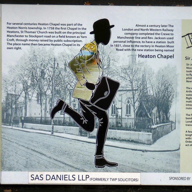
Image: © Gerald England Taken: 25 Jun 2015
Panel 3 was sponsored by SAS Daniels LLP (formerly TWP Solicitors) and informs us: For several centuries Heaton Chapel was part of the Heaton Norris township. In 1758 the first Chapel in the Heatons, St Thomas' Church was built on the principal Manchester to Stockport road on a field known as Yarn Croft, through money raised by public subscription. The place name then became Heaton Chapel in its own right. Almost a century later The London and North Western Railway company completed the Crewe to Manchester line and Rev. Jackson used personal influence, to have a station built in 1851, close to the rectory in Heaton Moor Road with the new station being named Heaton Chapel
Images are licensed for reuse under creativecommons.org/licenses/by-sa/2.0
Image Location
Latitude
53.425737
Longitude
-2.179494