SE end/start of the B4546, Cardigan
Introduction
The photograph on this page of SE end/start of the B4546, Cardigan by Jaggery as part of the Geograph project.
The Geograph project started in 2005 with the aim of publishing, organising and preserving representative images for every square kilometre of Great Britain, Ireland and the Isle of Man.

There are currently over 7.5m images from over 14,400 individuals and you can help contribute to the project by visiting https://www.geograph.org.uk
SE end/start of the B4546, Cardigan
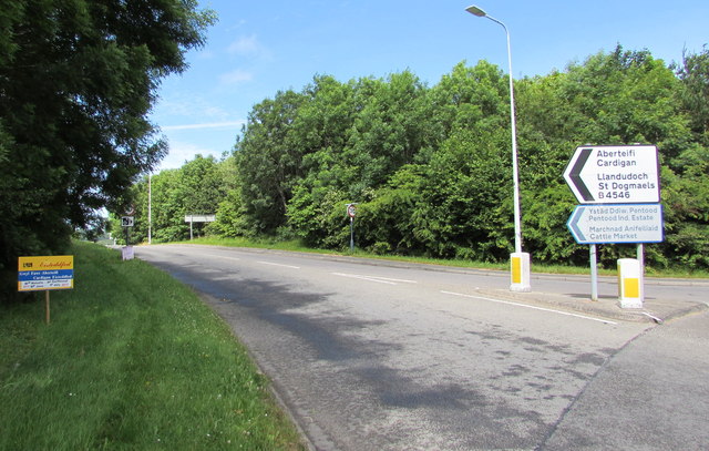
Image: © Jaggery Taken: 26 Jun 2015
Near the southern edge of Cardigan, the B4546 heads away from the roundabout junction with the A478 and A487. This way for Cardigan cattle market, Pentood Industrial Estate, central Cardigan and St Dogmaels. The notice on the left shows that the Cardigan Eistedfodd (Gwyl Fawr Aberteifi in Welsh) will take place from June 30th 2015 - July 5th 2015. Viewed on June 26th 2015.
Images are licensed for reuse under creativecommons.org/licenses/by-sa/2.0
Image Location


Leaflet Map data © OpenStreetMap
Latitude
52.076702
Longitude
-4.657071