The Ramsgate Home for Smack Boys
Introduction
The photograph on this page of The Ramsgate Home for Smack Boys by Keith Edkins as part of the Geograph project.
The Geograph project started in 2005 with the aim of publishing, organising and preserving representative images for every square kilometre of Great Britain, Ireland and the Isle of Man.

There are currently over 7.5m images from over 14,400 individuals and you can help contribute to the project by visiting https://www.geograph.org.uk
The Ramsgate Home for Smack Boys
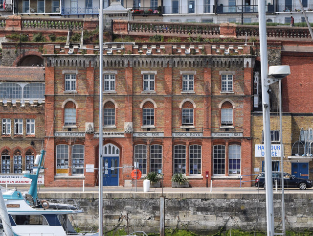
Image: © Keith Edkins Taken: 23 Jun 2015
Look, stop sniggering! Smacks were small boats, and the boys in the crews had nowhere to stay when on shore. It was a very charitable enterprise in 1881.
Images are licensed for reuse under creativecommons.org/licenses/by-sa/2.0
Image Location
Latitude
51.33006
Longitude
1.417042