The Drove, Brighton
Introduction
The photograph on this page of The Drove, Brighton by Simon Carey as part of the Geograph project.
The Geograph project started in 2005 with the aim of publishing, organising and preserving representative images for every square kilometre of Great Britain, Ireland and the Isle of Man.

There are currently over 7.5m images from over 14,400 individuals and you can help contribute to the project by visiting https://www.geograph.org.uk
The Drove, Brighton
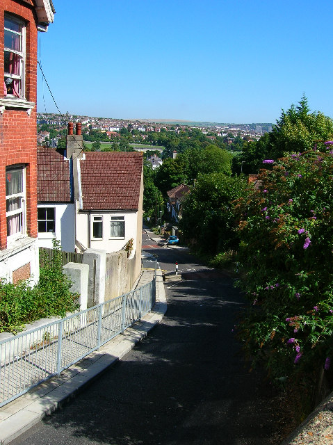
Image: © Simon Carey Taken: 29 Aug 2005
One of the steepest roads in the city. The road starts at Preston Manor moving west under the railway before climbing up towards Dyke Road. The picture was taken from the halfway up looking east. The hilly nature of Brighton can be seen in the background. Preston Church can be seen in the trees before the open expanse of Preston Park. Behind it the hills rise again before heading into the suburb of Hollingbury. The downs dip again after that before rising into farmland in the distance.
Images are licensed for reuse under creativecommons.org/licenses/by-sa/2.0
Image Location
Latitude
50.846193
Longitude
-0.159064