Lairgate, Beverley, Yorkshire
Introduction
The photograph on this page of Lairgate, Beverley, Yorkshire by Bernard Sharp as part of the Geograph project.
The Geograph project started in 2005 with the aim of publishing, organising and preserving representative images for every square kilometre of Great Britain, Ireland and the Isle of Man.

There are currently over 7.5m images from over 14,400 individuals and you can help contribute to the project by visiting https://www.geograph.org.uk
Lairgate, Beverley, Yorkshire
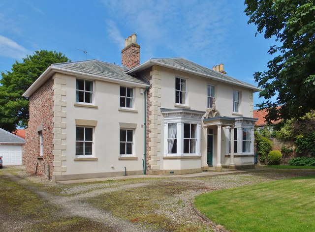
Image: © Bernard Sharp Taken: 24 Jun 2015
Holborn House, No.110 Lairgate, a stuccoed Regency villa, circa 1825; later extension to the south. Over the porch is a wall treatment of decorative ogee tracery with poppy head and crockets. Grade II Listed Building http://www.britishlistedbuildings.co.uk/en-167271-holborn-house-beverley-#.VY71RJXbKUl
Images are licensed for reuse under creativecommons.org/licenses/by-sa/2.0
Image Location
Latitude
53.837969
Longitude
-0.430741