Flooding at Creeton, near Bourne, Lincolnshire
Introduction
The photograph on this page of Flooding at Creeton, near Bourne, Lincolnshire by Rex Needle as part of the Geograph project.
The Geograph project started in 2005 with the aim of publishing, organising and preserving representative images for every square kilometre of Great Britain, Ireland and the Isle of Man.

There are currently over 7.5m images from over 14,400 individuals and you can help contribute to the project by visiting https://www.geograph.org.uk
Flooding at Creeton, near Bourne, Lincolnshire
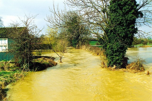
Image: © Rex Needle Taken: 21 Mar 1999
The West Glen River burst its banks in March 1999 after a period of heavy rain which brought flooding to many areas, particularly here at the village of Creeton where water flowed into the road and surrounding meadows, turning the countryside into muddy lakes and cutting off houses on either side of the approach road. See also Image
Images are licensed for reuse under creativecommons.org/licenses/by-sa/2.0
Image Location
Latitude
52.767309
Longitude
-0.500933