Pond in the Hurtwood
Introduction
The photograph on this page of Pond in the Hurtwood by Stefan Czapski as part of the Geograph project.
The Geograph project started in 2005 with the aim of publishing, organising and preserving representative images for every square kilometre of Great Britain, Ireland and the Isle of Man.

There are currently over 7.5m images from over 14,400 individuals and you can help contribute to the project by visiting https://www.geograph.org.uk
Pond in the Hurtwood
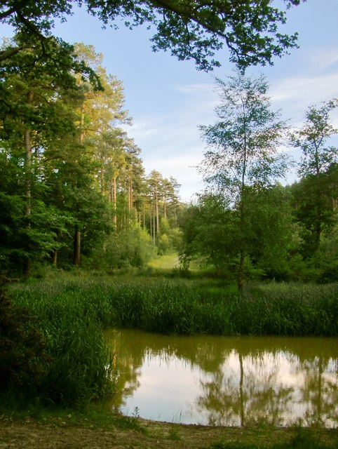
Image: © Stefan Czapski Taken: 25 Jun 2015
View south across the pond, towards a track which runs up a wooded valley towards the summit of Holmbury Hill. The OS plots the pond on the 1:25K mapping, but - curiously - not on the larger scale mappings. I took the photo while standing on a raised causeway, with my back to a second pond at lower level. The second pond is less overgrown with reeds - but seems to have escaped the notice of the OS altogether. My guess is that these ponds owe their origin to the iron industry which flourished in these hills in the centuries before the Industrial Revolution. If I'm right, then there may well be more ponds (or traces of ponds) along the valley.
Images are licensed for reuse under creativecommons.org/licenses/by-sa/2.0
Image Location
Latitude
51.192626
Longitude
-0.425081