Ingliston Farm
Introduction
The photograph on this page of Ingliston Farm by Raymond Okonski as part of the Geograph project.
The Geograph project started in 2005 with the aim of publishing, organising and preserving representative images for every square kilometre of Great Britain, Ireland and the Isle of Man.

There are currently over 7.5m images from over 14,400 individuals and you can help contribute to the project by visiting https://www.geograph.org.uk
Ingliston Farm
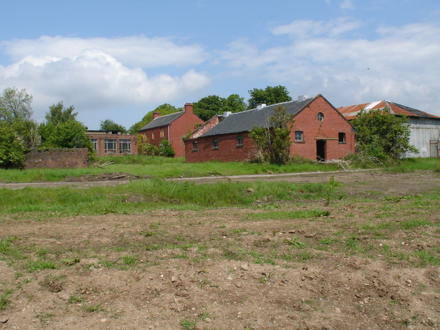
Image: © Raymond Okonski Taken: 1 Jun 2007
The farmhouse is in the distance with the red-brick chimneys. The other buildings surrounding it were part of the former Royal Ordnance Factory at Bishopton which effectively took over and adapted the buildings on site as part of the process of manufacturing armament propellants. BAE Systems now operate this site and are preparing it for a gradual handover to civilian use. With thanks to BAE Site Remediation for access.
Images are licensed for reuse under creativecommons.org/licenses/by-sa/2.0
Image Location
Latitude
55.905421
Longitude
-4.517954