The Horseshoe Pass
Introduction
The photograph on this page of The Horseshoe Pass by Philip Halling as part of the Geograph project.
The Geograph project started in 2005 with the aim of publishing, organising and preserving representative images for every square kilometre of Great Britain, Ireland and the Isle of Man.

There are currently over 7.5m images from over 14,400 individuals and you can help contribute to the project by visiting https://www.geograph.org.uk
The Horseshoe Pass
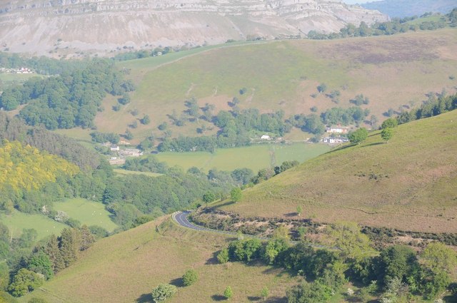
Image: © Philip Halling Taken: 10 Jun 2015
View over the Horseshoe Pass above Pentredwr, the A542 can be seen contouring the hill in the foreground.
Images are licensed for reuse under creativecommons.org/licenses/by-sa/2.0
Image Location
Latitude
53.010211
Longitude
-3.198406