Tolverne Cottage, Cornwall showing WWII slipway
Introduction
The photograph on this page of Tolverne Cottage, Cornwall showing WWII slipway by Callum MacLeod as part of the Geograph project.
The Geograph project started in 2005 with the aim of publishing, organising and preserving representative images for every square kilometre of Great Britain, Ireland and the Isle of Man.

There are currently over 7.5m images from over 14,400 individuals and you can help contribute to the project by visiting https://www.geograph.org.uk
Tolverne Cottage, Cornwall showing WWII slipway
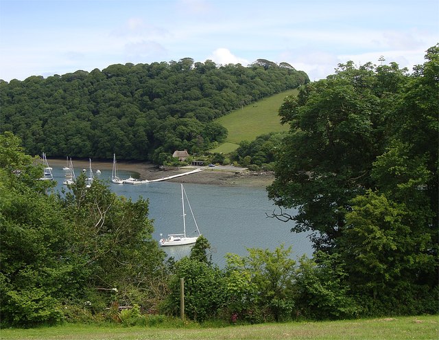
Image: © Callum MacLeod Taken: 21 Jun 2015
Tolverne Cottage AKA Smugglers Cottage, lies on the Eastern shore of the River Fal. Viewed from the Halwyn Tea Garden on the opposite bank,the "hard" or slipway that was used as an embarkation point for US troops in the invasion of Europe in 1944 can be seen beside the pontoon.
Images are licensed for reuse under creativecommons.org/licenses/by-sa/2.0
Image Location
Latitude
50.222649
Longitude
-5.021886