Hampers Farm
Introduction
The photograph on this page of Hampers Farm by Andy Potter as part of the Geograph project.
The Geograph project started in 2005 with the aim of publishing, organising and preserving representative images for every square kilometre of Great Britain, Ireland and the Isle of Man.

There are currently over 7.5m images from over 14,400 individuals and you can help contribute to the project by visiting https://www.geograph.org.uk
Hampers Farm
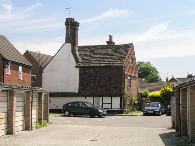
Image: © Andy Potter Taken: 22 May 2007
A 17th century (probably earlier) farmhouse engulfed in the tide of progress. The developers couldn't even spare a couple of metres of garden around this building. Don't you just know they were itching to knock it down but couldn't so they hedged it in as close as they could without making it actually impossible to sell.
Images are licensed for reuse under creativecommons.org/licenses/by-sa/2.0
Image Location
Latitude
51.065055
Longitude
-0.31795