Hampers Farm
Introduction
The photograph on this page of Hampers Farm by Andy Potter as part of the Geograph project.
The Geograph project started in 2005 with the aim of publishing, organising and preserving representative images for every square kilometre of Great Britain, Ireland and the Isle of Man.

There are currently over 7.5m images from over 14,400 individuals and you can help contribute to the project by visiting https://www.geograph.org.uk
Hampers Farm
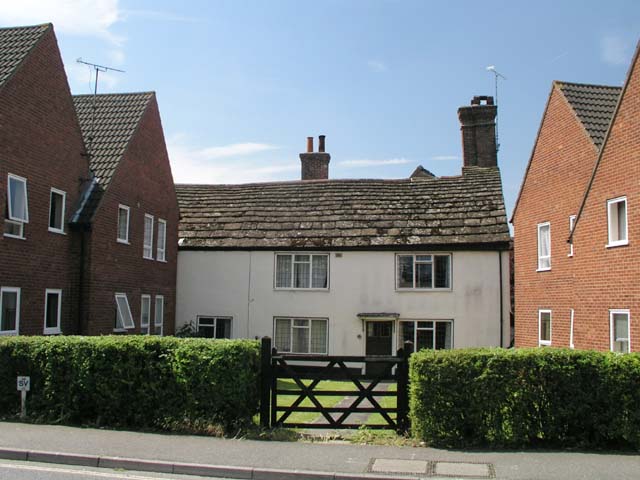
Image: © Andy Potter Taken: 22 May 2007
Records show this farm was in existence in the 17th century but it is almost certainly older. Now in Station Road this farm would have been on either Hurst Road or Oakhill Road before the railway cut through. Whilst I was standing outside Image taking this photograph I was approached by a lady who told me that she remembered that, as a child, she regularly saw chickens from the farm in the road where we were standing. You may find it hard to believe but the brick buildings on either side of the white building in the centre are not part of the original farm but were skilfully designed and built to be crammed in next to it so as to be "in keeping" with this historically significant building. It is reassuring to know that the local planning office is doing such outstanding work in not only preserving our architectural heritage but also endeavours to maintain the context of that heritage.
Images are licensed for reuse under creativecommons.org/licenses/by-sa/2.0
Image Location
Latitude
51.065055
Longitude
-0.31795