Northern end of the Queen Alexandra Bridge
Introduction
The photograph on this page of Northern end of the Queen Alexandra Bridge by Oliver Dixon as part of the Geograph project.
The Geograph project started in 2005 with the aim of publishing, organising and preserving representative images for every square kilometre of Great Britain, Ireland and the Isle of Man.

There are currently over 7.5m images from over 14,400 individuals and you can help contribute to the project by visiting https://www.geograph.org.uk
Northern end of the Queen Alexandra Bridge
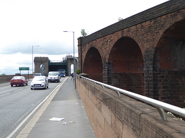
Image: © Oliver Dixon Taken: 19 Jun 2015
The Queen Alexandra Bridge over the River Wear was built in 1909 and was originally a double-decker bridge with a railway on the top (long since discontinued and dismantled). In the foreground are the brick arches of the former railway. The bridge is a Grade II listed structure and its lattice girder construction is the heaviest ever built. Cycle- and foot-ways pass under the arches seen in the distance to span the river on the outside of the girders.
Images are licensed for reuse under creativecommons.org/licenses/by-sa/2.0
Image Location
Latitude
54.915433
Longitude
-1.406407