Railway Bridge SAC 277m 1220yds, Long Marton Road
Introduction
The photograph on this page of Railway Bridge SAC 277m 1220yds, Long Marton Road by Roger Templeman as part of the Geograph project.
The Geograph project started in 2005 with the aim of publishing, organising and preserving representative images for every square kilometre of Great Britain, Ireland and the Isle of Man.

There are currently over 7.5m images from over 14,400 individuals and you can help contribute to the project by visiting https://www.geograph.org.uk
Railway Bridge SAC 277m 1220yds, Long Marton Road
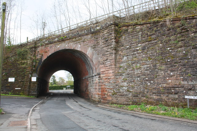
Image: © Roger Templeman Taken: 7 May 2015
The bridge carries the Settle-Carlisle Railway, here 277+ miles via the Midland Railway route to London. There is an OS benchmark Image on the bridge wall left of the arch.
Images are licensed for reuse under creativecommons.org/licenses/by-sa/2.0
Image Location
Latitude
54.584716
Longitude
-2.494636