Crossing on the Consett and Sunderland railway path
Introduction
The photograph on this page of Crossing on the Consett and Sunderland railway path by Oliver Dixon as part of the Geograph project.
The Geograph project started in 2005 with the aim of publishing, organising and preserving representative images for every square kilometre of Great Britain, Ireland and the Isle of Man.

There are currently over 7.5m images from over 14,400 individuals and you can help contribute to the project by visiting https://www.geograph.org.uk
Crossing on the Consett and Sunderland railway path
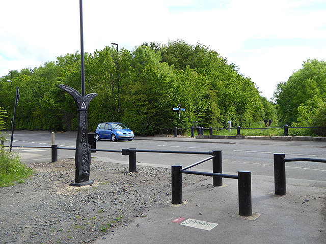
Image: © Oliver Dixon Taken: 19 Jun 2015
The Consett and Sunderland Railway Path forms part of the world-famous C2C cycle route. Here it crosses Biddick Land in Washington, and barriers have been erected to slow cyclists down. The National Cycle Network is marked at intervals by specially designed mileposts donated to the project by the Royal Bank of Scotland. There are four designs - one each by an Englishman, a Welshman, a Scotsman and an Irishman. The example seen here on the left is an "English" one, entitled "the Fossil Tree" and designed by John Mills. The arms indicate Chester-le-Street 3.5 miles and Consett 15 miles to the left and Wildfowl Trust 2 miles and Roker Pier 9 miles to the right.
Images are licensed for reuse under creativecommons.org/licenses/by-sa/2.0
Image Location
Latitude
54.886908
Longitude
-1.519844