Haltemprice Priory Farm at Sunset
Introduction
The photograph on this page of Haltemprice Priory Farm at Sunset by Chris Rowson as part of the Geograph project.
The Geograph project started in 2005 with the aim of publishing, organising and preserving representative images for every square kilometre of Great Britain, Ireland and the Isle of Man.

There are currently over 7.5m images from over 14,400 individuals and you can help contribute to the project by visiting https://www.geograph.org.uk
Haltemprice Priory Farm at Sunset
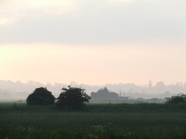
Image: © Chris Rowson Taken: 1 Jun 2007
The site of Haltemprice Priory Farm at sunset. Photo taken from the rear of properties at Chester Road. The original monastic buildings of Haltemprice Priory (1320 >) have long since gone, although ruins of a farmhouse, built 1584 remain on site and incorporate some of the Priory stonework. This photo shows the ruins of the 16th Century farmhouse which has fallen into decline over the past 20 years or so. In the distance (mid right) construction can be seen taking place at Castle Hill Hospital. For more on Haltemprice Priory see: http://en.wikipedia.org/wiki/Haltemprice_Priory
Images are licensed for reuse under creativecommons.org/licenses/by-sa/2.0
Image Location
Latitude
53.76439
Longitude
-0.420135