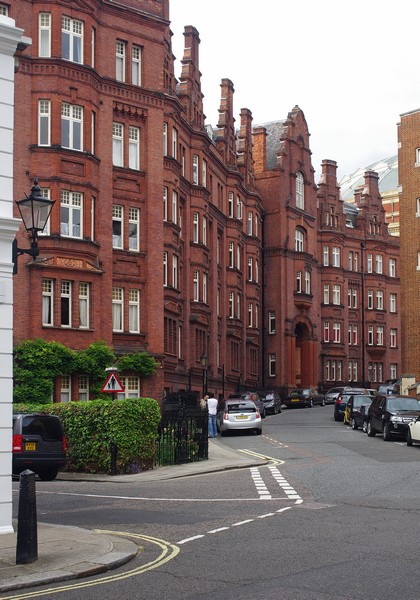
Queen Alexandra's House, Kensington Gore, London SW7
Introduction
The photograph on this page of Queen Alexandra's House, Kensington Gore, London SW7 by Jim Osley as part of the Geograph project.
The Geograph project started in 2005 with the aim of publishing, organising and preserving representative images for every square kilometre of Great Britain, Ireland and the Isle of Man.
There are currently over 7.5m images from over 14,400 individuals and you can help contribute to the project by visiting https://www.geograph.org.uk

Image: © Jim Osley Taken: 15 Jun 2015
Grade II listed building of 1884, built as student accommodation for women. Architectural description at this http://list.historicengland.org.uk/resultsingle.aspx?uid=1217740 and this http://www.british-history.ac.uk/survey-london/vol38/pp325-348#h3-0012. The latter records that "the design for the building was prepared by Mr. C. Purdon Clarke, but that 'his plans were transferred to the late Mr. Robert Down for execution: Mr. Clarke, as an officer of the Science and Art Department, not having time to attend to the work". For more on the life and work of Caspar Purdon Clarke, architect and museum director, there is an entry in the Oxford Dictionary of National Biography or at this https://dictionaryofarthistorians.org/clarkec.htm.

