Muirkirk Forest
Introduction
The photograph on this page of Muirkirk Forest by Richard Webb as part of the Geograph project.
The Geograph project started in 2005 with the aim of publishing, organising and preserving representative images for every square kilometre of Great Britain, Ireland and the Isle of Man.

There are currently over 7.5m images from over 14,400 individuals and you can help contribute to the project by visiting https://www.geograph.org.uk
Muirkirk Forest
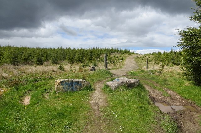
Image: © Richard Webb Taken: 7 Jun 2015
The young trees grow on the site of an open cast mine. The land was wooded before the mining and moorland (Burnfoot Moor) before that. The boulders attempt to close off a path to Smallburn to the quadbikes but they just go round. They were about at this time too.
Images are licensed for reuse under creativecommons.org/licenses/by-sa/2.0
Image Location
Latitude
55.522106
Longitude
-4.08053