Aldenham Social Club
Introduction
The photograph on this page of Aldenham Social Club by Robin Webster as part of the Geograph project.
The Geograph project started in 2005 with the aim of publishing, organising and preserving representative images for every square kilometre of Great Britain, Ireland and the Isle of Man.

There are currently over 7.5m images from over 14,400 individuals and you can help contribute to the project by visiting https://www.geograph.org.uk
Aldenham Social Club
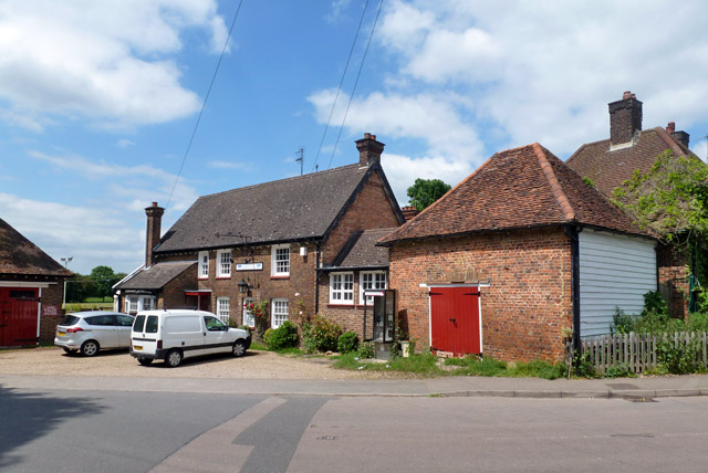
Image: © Robin Webster Taken: 10 Jun 2015
Obviously a former pub, and the nearby Red Lion Close and Cottages suggest its name. This might be a red herring, it is called The Chequers on old maps. However, the local authority on discussing the conservation merits of Red Lion Cottages refer to them as being built behind the pub of that name. Perhaps it changed its name. It became a club before WWII. It is a grade II listed building with oldest parts early 16th century, when it appears to have been an ordinary house according to the citation.
Images are licensed for reuse under creativecommons.org/licenses/by-sa/2.0
Image Location
Latitude
51.674166
Longitude
-0.353043