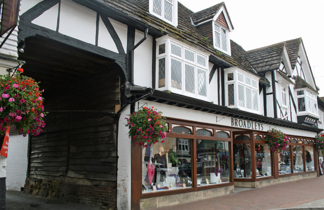
40 to 34 High Street, East Grinstead
Introduction
The photograph on this page of 40 to 34 High Street, East Grinstead by Jo and Steve Turner as part of the Geograph project.
The Geograph project started in 2005 with the aim of publishing, organising and preserving representative images for every square kilometre of Great Britain, Ireland and the Isle of Man.
There are currently over 7.5m images from over 14,400 individuals and you can help contribute to the project by visiting https://www.geograph.org.uk

Image: © Jo and Steve Turner Taken: 20 Sep 2009
Grade II Listed shop with 14th century timber framing formerly the site of the Lion Inn mentioned in a will of 1619. The building actually comprises two medieval structures, 36-40 having a broad frontage parallel to the street, and 34 representing a range at right-angles to the street; the presence of a primary cart entrance could suggest a courtyard plan from the outset. The front range, which has an aisled hall, has been dated by dendrochronology to 1352.

