Topham Ferry Bridge
Introduction
The photograph on this page of Topham Ferry Bridge by Graham Hogg as part of the Geograph project.
The Geograph project started in 2005 with the aim of publishing, organising and preserving representative images for every square kilometre of Great Britain, Ireland and the Isle of Man.

There are currently over 7.5m images from over 14,400 individuals and you can help contribute to the project by visiting https://www.geograph.org.uk
Topham Ferry Bridge
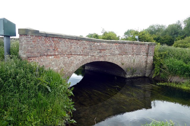
Image: © Graham Hogg Taken: 9 Jun 2015
The bridge over the River Went is a grade II listed building. It dates from the 19th century and is now in need of some TLC.Presumably the river was once so wide that it needed a ferry to cross?
Images are licensed for reuse under creativecommons.org/licenses/by-sa/2.0
Image Location


Leaflet Map data © OpenStreetMap
Latitude
53.649169
Longitude
-1.063661