Christ Church, Tunstall
Introduction
The photograph on this page of Christ Church, Tunstall by David Weston as part of the Geograph project.
The Geograph project started in 2005 with the aim of publishing, organising and preserving representative images for every square kilometre of Great Britain, Ireland and the Isle of Man.

There are currently over 7.5m images from over 14,400 individuals and you can help contribute to the project by visiting https://www.geograph.org.uk
Christ Church, Tunstall
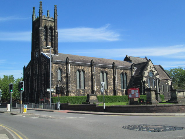
Image: © David Weston Taken: 4 Jun 2015
The church was built in 1832. Seen from the south-west, at the junction of the main road north of Tunstall (the A50) with Furlong Road. The dark patch on the road at the bottom right of the photo is a mini-roundabout.
Images are licensed for reuse under creativecommons.org/licenses/by-sa/2.0
Image Location
Latitude
53.062358
Longitude
-2.211253