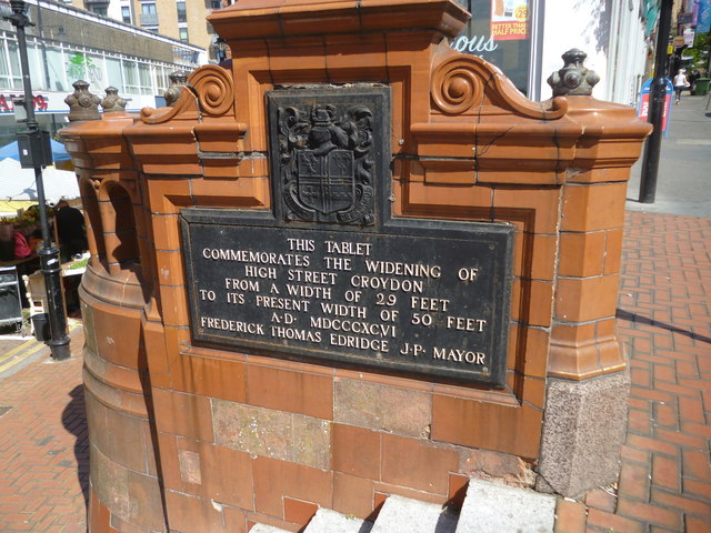
Croydon: commemorative plaque
Introduction
The photograph on this page of Croydon: commemorative plaque by Dr Neil Clifton as part of the Geograph project.
The Geograph project started in 2005 with the aim of publishing, organising and preserving representative images for every square kilometre of Great Britain, Ireland and the Isle of Man.
There are currently over 7.5m images from over 14,400 individuals and you can help contribute to the project by visiting https://www.geograph.org.uk

Image: © Dr Neil Clifton Taken: 4 Jun 2015
This plaque is attached to the back of a drinking fountain at the junction of Surrey Street and Croydon High Street, the junction often referred to as Millett's Corner. The plaque commemorates the widening of High Street in 1896 from 29ft to 50ft. This was for electric trams, which eventually ran through from Embankment to Purley on the 16 and 18 routes. These trams, which were red double-deckers, ran until 1950 when they were replaced by buses on Route 109, but ironically, electric power seems to have hit back here, because just recently, Abellio have started to operate hybrid buses on this route. And Croydon now has trams once more, as since 2000 modern single-deckers have operated through the town, though now on an east-west alignment. Perhaps one day there will be trams again to Purley, and even Coulsdon, who knows?

