Flood defence work near Hull
Introduction
The photograph on this page of Flood defence work near Hull by Paul Harrop as part of the Geograph project.
The Geograph project started in 2005 with the aim of publishing, organising and preserving representative images for every square kilometre of Great Britain, Ireland and the Isle of Man.

There are currently over 7.5m images from over 14,400 individuals and you can help contribute to the project by visiting https://www.geograph.org.uk
Flood defence work near Hull
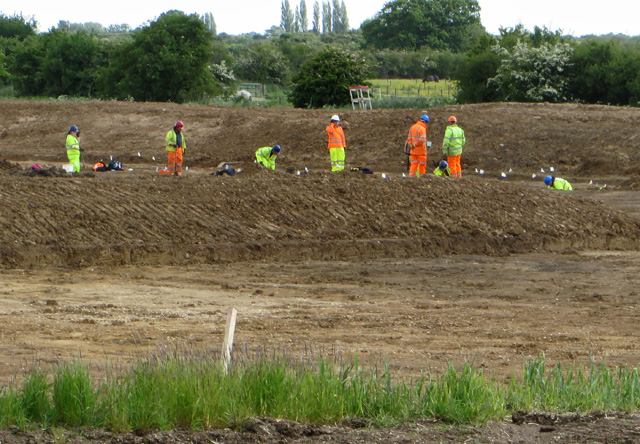
Image: © Paul Harrop Taken: 1 Jun 2015
Work is being done here to build one of a series of rainwater storage lagoons on former farm land at Willerby Carrs. They form part of the Willerby and Derringham Flood Alleviation Scheme. It is among schemes to reduce the risk of flooding in the Derringham area of Hull and parts of Willerby, following the extensive floods of summer 2007. The lagoons will resemble flat pasture and most of the time will remain dry, only to be filled during severe wet weather. The £14.4m scheme aims to protect around 8,000 homes, and is due for completion in autumn 2015.
Images are licensed for reuse under creativecommons.org/licenses/by-sa/2.0
Image Location
Latitude
53.761738
Longitude
-0.416745