
Roebuck Ferry Cottage
Introduction
The photograph on this page of Roebuck Ferry Cottage by Rose and Trev Clough as part of the Geograph project.
The Geograph project started in 2005 with the aim of publishing, organising and preserving representative images for every square kilometre of Great Britain, Ireland and the Isle of Man.

There are currently over 7.5m images from over 14,400 individuals and you can help contribute to the project by visiting https://www.geograph.org.uk
Roebuck Ferry Cottage
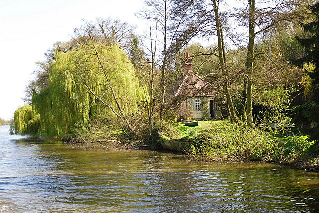
Image: © Rose and Trev Clough Taken: 18 Apr 2015
In the late 18th century a Purley farmer refused to allow a towpath on his land, so a diversion to the opposite bank was established using two ferries. One was here, the other a short distance upstream near Purley Church (information from 'Ferries of the Upper Thames' by J.Tucker https://www.amberley-books.com/discover-books/transport-industry/ferries-of-the-upper-thames-9781848689671.html ). A photo of the cottage taken in 1899 is available at Francis Frith http://www.francisfrith.com/tilehurst/tilehurst-roebuck-ferry-house-1899_43007 . This looks like an idyllic riverside retreat, but the busy Great Western railway line is just feet away behind the trees. The only access from Oxford Road is by a steep railway footbridge and path, so furniture must have to be shifted by boat.
Images are licensed for reuse under creativecommons.org/licenses/by-sa/2.0
Image Location

Latitude
51.475041
Longitude
-1.036408