The Chapel
Introduction
The photograph on this page of The Chapel by Alexander P Kapp as part of the Geograph project.
The Geograph project started in 2005 with the aim of publishing, organising and preserving representative images for every square kilometre of Great Britain, Ireland and the Isle of Man.

There are currently over 7.5m images from over 14,400 individuals and you can help contribute to the project by visiting https://www.geograph.org.uk
The Chapel
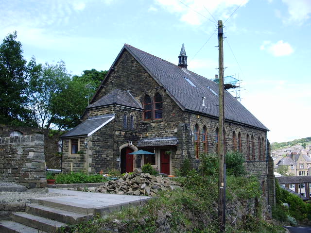
Image: © Alexander P Kapp Taken: 29 May 2007
Converted in the 1960s to a house before that it was a Primitive Methodist Chapel, before that it was the Sunday School for the chapel which was originally built where the garden of the house is now. The chapel was demolished in the early 1950s
Images are licensed for reuse under creativecommons.org/licenses/by-sa/2.0
Image Location


Leaflet Map data © OpenStreetMap
Latitude
53.723214
Longitude
-2.289723