St Martins House, Princess Street
Introduction
The photograph on this page of St Martins House, Princess Street by John S Turner as part of the Geograph project.
The Geograph project started in 2005 with the aim of publishing, organising and preserving representative images for every square kilometre of Great Britain, Ireland and the Isle of Man.

There are currently over 7.5m images from over 14,400 individuals and you can help contribute to the project by visiting https://www.geograph.org.uk
St Martins House, Princess Street
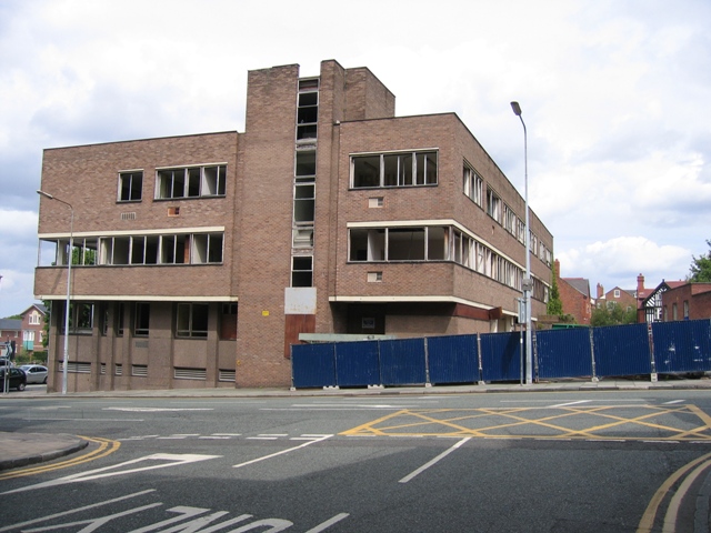
Image: © John S Turner Taken: 20 May 2007
Derelict for many years this prominent office block is now being demolished as part of the Northgate Development of Chester city centre. It is estimated the entire project will take about four years. Viewed from Trinity Street, Princess Street crosses the photo and joins St Martins Way out of sight to the left.
Images are licensed for reuse under creativecommons.org/licenses/by-sa/2.0
Image Location
Latitude
53.191499
Longitude
-2.895128