The Three Shires: Blue plaque
Introduction
The photograph on this page of The Three Shires: Blue plaque by Gerald England as part of the Geograph project.
The Geograph project started in 2005 with the aim of publishing, organising and preserving representative images for every square kilometre of Great Britain, Ireland and the Isle of Man.

There are currently over 7.5m images from over 14,400 individuals and you can help contribute to the project by visiting https://www.geograph.org.uk
The Three Shires: Blue plaque
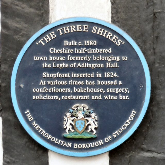
Image: © Gerald England Taken: 21 May 2015
The blue plaque on the side of The Three Shires Image on Great Underbank reads: 'THE THREE SHIRES' Built c. 1580 Cheshire half-timbered town house formerly belonging to the Leghs of Adlington Hall. Shopfront inserted in 1824. At various times has housed a confectioners, bakehouse, surgery, solicitors, restaurant and wine bar. THE METROPOLITAN BOROUGH OF STOCKPORT
Images are licensed for reuse under creativecommons.org/licenses/by-sa/2.0
Image Location
Latitude
53.411026
Longitude
-2.158671