Pranket's Well, Stoke Sub Hamdon
Introduction
The photograph on this page of Pranket's Well, Stoke Sub Hamdon by Becky Williamson as part of the Geograph project.
The Geograph project started in 2005 with the aim of publishing, organising and preserving representative images for every square kilometre of Great Britain, Ireland and the Isle of Man.

There are currently over 7.5m images from over 14,400 individuals and you can help contribute to the project by visiting https://www.geograph.org.uk
Pranket's Well, Stoke Sub Hamdon
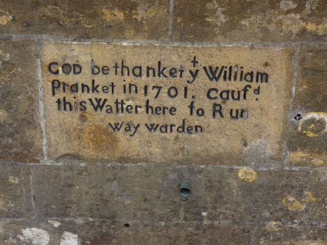
Image: © Becky Williamson Taken: 22 May 2015
Plaque on Pranket's Well. Until the early C20 there was no mains water supply in the village of Stoke Sub Hamdon. While some houses had wells the majority would have to queue to use Pranket's well, supplied by surface water from Hamdon Hill. The stone from which the conduit opened was inscribed "God be thanket, William Prankett, in 1701, caused this water here to run". A Dr Stanley Brimblecome in the first half of the C20 analysed the water and found it to contain potentially dangerous impurities, providing the impetus for a mains water supply. (Info from somerset.gov.uk)
Images are licensed for reuse under creativecommons.org/licenses/by-sa/2.0
Image Location
Latitude
50.953621
Longitude
-2.749652