Demolition of Time Square, Warrington continues
Introduction
The photograph on this page of Demolition of Time Square, Warrington continues by Matt Harrop as part of the Geograph project.
The Geograph project started in 2005 with the aim of publishing, organising and preserving representative images for every square kilometre of Great Britain, Ireland and the Isle of Man.

There are currently over 7.5m images from over 14,400 individuals and you can help contribute to the project by visiting https://www.geograph.org.uk
Demolition of Time Square, Warrington continues
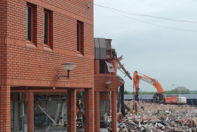
Image: © Matt Harrop Taken: 21 May 2015
The latest of the demolition shots I'll be taking as Warrington's Bridge Street is redeveloped shows the former Lloyds TSB building partially pulled down.
Images are licensed for reuse under creativecommons.org/licenses/by-sa/2.0
Image Location
Latitude
53.388809
Longitude
-2.591924