Burnham Green: Listed Boundary Stone & Village Hall
Introduction
The photograph on this page of Burnham Green: Listed Boundary Stone & Village Hall by Nigel Cox as part of the Geograph project.
The Geograph project started in 2005 with the aim of publishing, organising and preserving representative images for every square kilometre of Great Britain, Ireland and the Isle of Man.

There are currently over 7.5m images from over 14,400 individuals and you can help contribute to the project by visiting https://www.geograph.org.uk
Burnham Green: Listed Boundary Stone & Village Hall
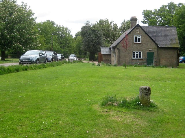
Image: © Nigel Cox Taken: 20 May 2015
The boundary stone was erected on 20 April 1830 for £2 1s 0d in order to settle a dispute and mark the common boundary point of Datchworth, Tewin, Digswell and Welwyn Parishes. It is a Grade II Listed structure. Beyond is the Village Hall.
Images are licensed for reuse under creativecommons.org/licenses/by-sa/2.0
Image Location
Latitude
51.832125
Longitude
-0.168626