33-37 Groat Market, NE1
Introduction
The photograph on this page of 33-37 Groat Market, NE1 by Mike Quinn as part of the Geograph project.
The Geograph project started in 2005 with the aim of publishing, organising and preserving representative images for every square kilometre of Great Britain, Ireland and the Isle of Man.

There are currently over 7.5m images from over 14,400 individuals and you can help contribute to the project by visiting https://www.geograph.org.uk
33-37 Groat Market, NE1
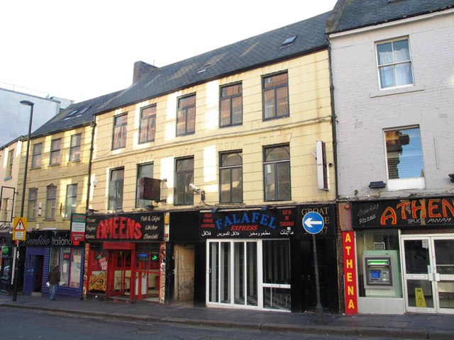
Image: © Mike Quinn Taken: 19 Nov 2013
Built in the mid to late 18th C, with 19th and 20th C alterations. These apparently simple and plain buildings have similar characterstics to Image and Image They look to be Victorianised, with plain pitched roofs, regular window patterns and external cement render marked to give the appearance of stonework. But internally there are 17th and 18th C features - see Image No. 33 and Nos. 35 & 37 are (separately) Grade II listed http://list.historicengland.org.uk/resultsingle.aspx?uid=1024843 and http://list.historicengland.org.uk/resultsingle.aspx?uid=1024844 . The Buildings of Grainger Town - No.127. See Image
Images are licensed for reuse under creativecommons.org/licenses/by-sa/2.0
Image Location


Leaflet Map data © OpenStreetMap
Latitude
54.970815
Longitude
-1.613508