Lord Sheldon Way
Introduction
The photograph on this page of Lord Sheldon Way by David Dixon as part of the Geograph project.
The Geograph project started in 2005 with the aim of publishing, organising and preserving representative images for every square kilometre of Great Britain, Ireland and the Isle of Man.

There are currently over 7.5m images from over 14,400 individuals and you can help contribute to the project by visiting https://www.geograph.org.uk
Lord Sheldon Way
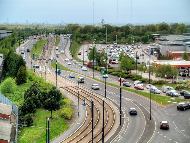
Image: © David Dixon Taken: 15 May 2015
Viewed here from the roof car park at the IKEA store, Lord Sheldon Way (A6140) is the town's north western bypass across Ashton Moss. The road is named after Baron Sheldon who, as Robert Sheldon, was Ashton's Member of Parliament between 1964 and 2001 and long-serving chairman of the House of Commons Public Accounts Committee. Sainsbury's supermarket is on the right hand side of the road.
Images are licensed for reuse under creativecommons.org/licenses/by-sa/2.0
Image Location
Latitude
53.490634
Longitude
-2.103806