Old Trafford Bridge Plaque
Introduction
The photograph on this page of Old Trafford Bridge Plaque by David Dixon as part of the Geograph project.
The Geograph project started in 2005 with the aim of publishing, organising and preserving representative images for every square kilometre of Great Britain, Ireland and the Isle of Man.

There are currently over 7.5m images from over 14,400 individuals and you can help contribute to the project by visiting https://www.geograph.org.uk
Old Trafford Bridge Plaque
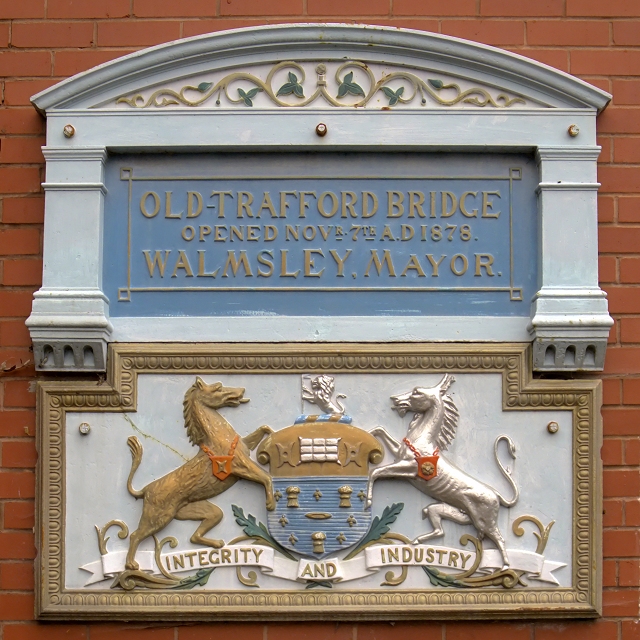
Image: © David Dixon Taken: 14 May 2015
Before the Manchester Ship Canal was built, the course of the River Irwell was approx. 50-100 yards further north of where the Ship Canal now passes under Trafford Road. This plaque is next to a pedestrian tunnel under Trafford Road, roughly on the line of the old navigation. The plaque indicates the site of the Old Trafford Bridge, opened by the Mayor of Salford, Mr. Alderman F.H. Walmsley on 7th November 1878 (pre-dating the Ship Canal by sixteen years).
Images are licensed for reuse under creativecommons.org/licenses/by-sa/2.0
Image Location
Latitude
53.466612
Longitude
-2.284055