Tiverton : The Walronds & Cherry Tree
Introduction
The photograph on this page of Tiverton : The Walronds & Cherry Tree by Lewis Clarke as part of the Geograph project.
The Geograph project started in 2005 with the aim of publishing, organising and preserving representative images for every square kilometre of Great Britain, Ireland and the Isle of Man.

There are currently over 7.5m images from over 14,400 individuals and you can help contribute to the project by visiting https://www.geograph.org.uk
Tiverton : The Walronds & Cherry Tree
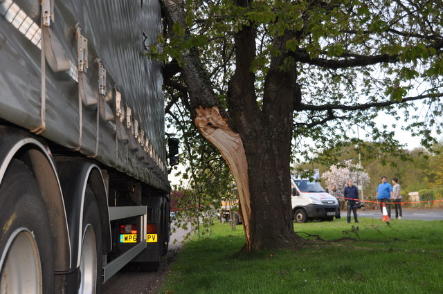
Image: © Lewis Clarke Taken: 30 Apr 2015
A lorry has caused some considerable damage to this cherry tree which has stood here for over sixty years.
Images are licensed for reuse under creativecommons.org/licenses/by-sa/2.0
Image Location
Latitude
50.895678
Longitude
-3.492542