Cut Mark: Lincoln, Michaelgate
Introduction
The photograph on this page of Cut Mark: Lincoln, Michaelgate by Brian Westlake as part of the Geograph project.
The Geograph project started in 2005 with the aim of publishing, organising and preserving representative images for every square kilometre of Great Britain, Ireland and the Isle of Man.

There are currently over 7.5m images from over 14,400 individuals and you can help contribute to the project by visiting https://www.geograph.org.uk
Cut Mark: Lincoln, Michaelgate
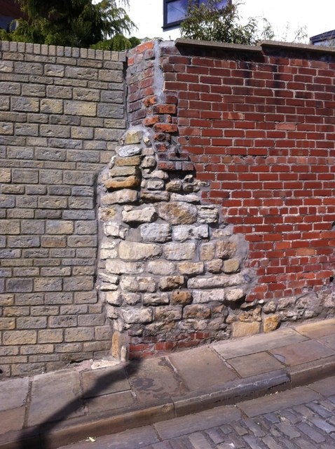
Image: © Brian Westlake Taken: 14 Apr 2015
A fragment of old stone wall on the north-west side of Michaelgate which carries a damaged cut bench mark. See http://www.geograph.org.uk/photo/4478584 for a close-up and http://www.bench-marks.org.uk/bm66697 for details.
Images are licensed for reuse under creativecommons.org/licenses/by-sa/2.0
Image Location


Leaflet Map data © OpenStreetMap
Latitude
53.232489
Longitude
-0.540169