Powdene House, Pudding Chare, NE1
Introduction
The photograph on this page of Powdene House, Pudding Chare, NE1 by Mike Quinn as part of the Geograph project.
The Geograph project started in 2005 with the aim of publishing, organising and preserving representative images for every square kilometre of Great Britain, Ireland and the Isle of Man.

There are currently over 7.5m images from over 14,400 individuals and you can help contribute to the project by visiting https://www.geograph.org.uk
Powdene House, Pudding Chare, NE1
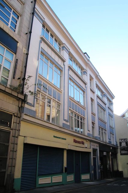
Image: © Mike Quinn Taken: 19 Nov 2013
Built c 1925, and named after a stream that now flows hidden under these parts. An interesting building with "Egyptian" detailing; it's a shame that it's tucked away down a narrow lane - see Image The Buildings of Grainger Town - No.121. See Image
Images are licensed for reuse under creativecommons.org/licenses/by-sa/2.0
Image Location


Leaflet Map data © OpenStreetMap
Latitude
54.970906
Longitude
-1.613976